On the morning of Friday, May 25, 2001, I dropped my kids, Janet and Greg, at school in Alta and headed a few miles down I-80 to the Gold Run exit. From Magra Road I turned onto Garrett, and a couple of winding miles south brought me to Knobcone Road, where the historic road to Iowa Hill from Gold Run forks away. Placer County allowed a subdivision here with no provision for public access to this ancient public way, and it is now gated closed, a little ways in. Instead of its true name--the Fords Bar Trail--the subdividers were allowed to attach a fake name to the old road, to disguise the truth.
A couple hundred yards past Knobcone Road, an unmarked road enters the forest on the left. This is BLM land, within the Gold Run Addition to the North Fork American Wild & Scenic River, but no signs advise one of that. The only hint that this is not one of the endless private parcels in Parcel County--oops, I meant to write, Placer County--is that the trees are more than two feet in diameter, and on private land, usually they would already be long gone to the sawmill, part of the ordinary, everyday process of log-and-subdivide that makes this county what it is.
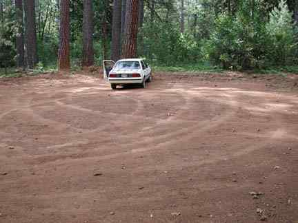
Following this unmarked, ungraveled road
into the lovely forest, I reached a turn-around area where off-the-road
vehicles have been having a spin-around festival for months now.
The BLM cannot afford to patrol this area, and the Placer County
Sheriff deputies could care less.
The Paleobotanist Trail leads away from
the parking area to the north, following another road for a ways,
passing still another road that can be used to get to a nice overlook
above the Diggings. Then with a shift to the right and the crossing
of a water bar, one enters still another road. I followed along
for a ways until astounded by a sight I am still wondering at:
a large group of Phantom Orchids (Eburophyton austinae).
with some other orchids (or perhaps Pyrolas) also in the vicinity.
There were 50 to 100 Phantoms.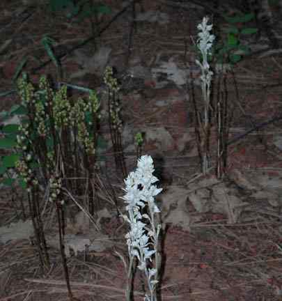
In the photo above, taken with a flash because of dim light in the heavy timber, several Phantom Orchids are visible, as well as clumps of the other, possibly orchid, species. Both in any case are saprophytes, and live off rotting vegetation without any chlorophyll, typically in association with certain fungi.
The Paleobotanist Trail was named because
it gives access to two paleobotanical sites, one of which Dave
Lawler discovered; and he and I led a group of paleobotanists
from all over the world there several years ago; the other site
I discovered. Both sites are near where the trail plunges over
the bluffs down into the diggings, in the higher strata of Eocene
gravels, and both sites are characterized by leaf impressions
in fine sediments, sandy clays for the most part. The leaves are
of extinct species of elm and oak and sycamore and willow.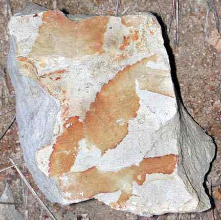
Continuing down into the diggings, I passed
a mesic area where abundant Madrones and Red Huckleberry grow.
Then it was out into the sun-baked expanse of manzanita and quartz
and petrified wood. This part of the trail is about 100 to 150
feet below the level of the Pine Grove atop the Bluffs, where
I had parked.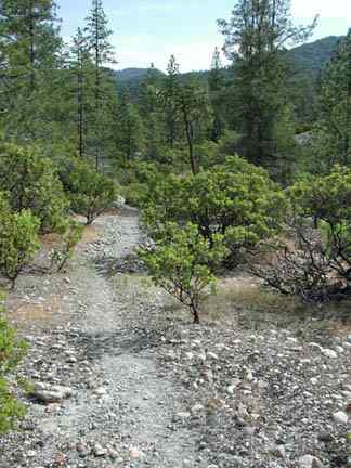
In the photo above, the trail is heading roughly east by northeast; Frost Hill is in the left background, and Moody Ridge in the right background. Ponderosa and Knobcone pines are visible, as well as the Whiteleaf Manzanita, Arctostaphylos viscida, which dominates the diggings.
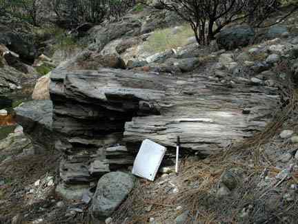
In a little ways the trail veers north and
leaves BLM lands, crossing into part of the 357 acres of private
land owned by Gold Run Properties, which North Fork Trails wants
the BLM to purchase. The property is now for sale. Where the trail
veers north, an inconspicuous spur continues east and wanders
to the south through BLM lands. The main trail, in another few
hundred yards, reaches the Main Diggings Road, where a spur road
continues east and south to Potato Ravine Pass and the head of
the Canyon Creek Trail.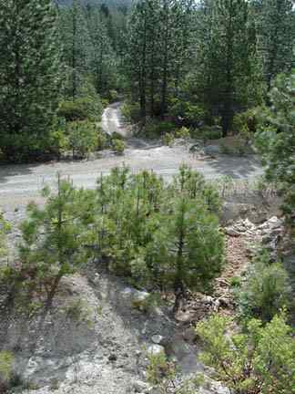
Above: the Paleobotanist Trail meets the Main Diggings Road, and the road to Potato Ravine Pass is seen in the middle distance.
I took GPS coordinate readings at intervals
along the Paleobotanist Trail, and it remained to obtain coordinates
for some of the petrified wood sites in the area, both on BLM
lands and on Gold Run Properties lands which are important acquisition
targets. The petrified wood of the old hydraulic mines of the
Sierra, once abundant, has been dragged off to adorn yards and
gardens and to be built into fireplaces and stone walls, and there
is hardly any left. This part of the diggings has little to no
road access, and most of the petrified wood is left. The wood
is about 55 million years old.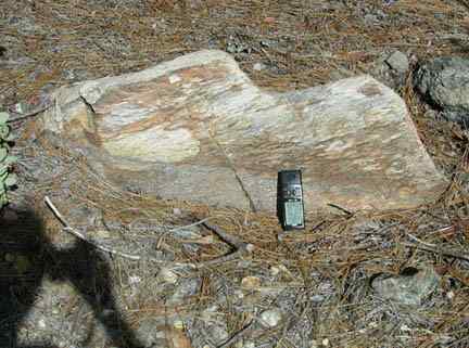
One piece of petrified wood was particularly
intriguing; hidden away beneath dense and old manzanita, it was
a portion of a log with a hollow center, which some animal had
made its burrow. The log fragment is about four feet long, two
feet in diameter, and the hollow center, one foot in diameter.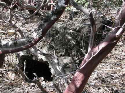
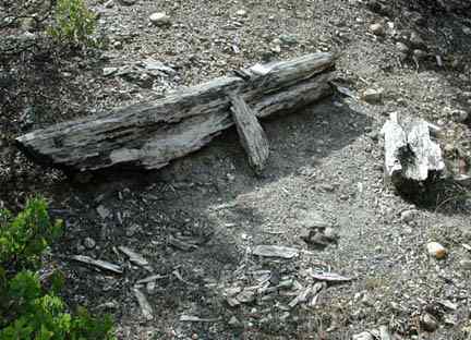
Two pieces of petrified wood in this area
have an upright orientation which suggest that they are in
situ remnants of trees somehow buried where they stood.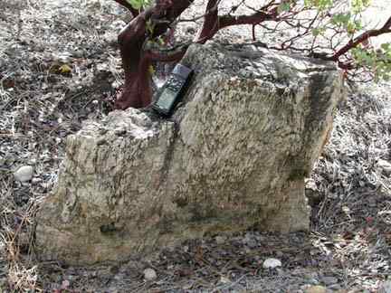
Some pieces are rather large, in the hundreds
of pounds range, some perhaps over a thousand pounds; a few are
shown below.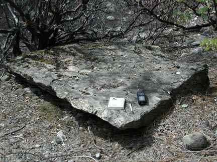
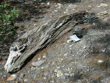
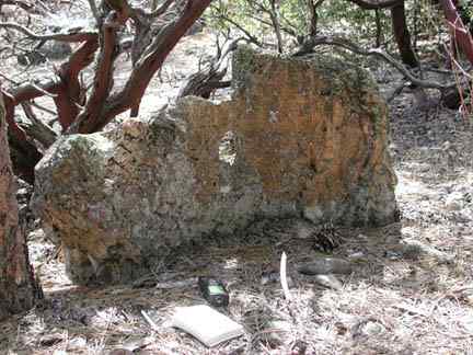
The above piece is on BLM lands at the base of the Bluffs near the Paleobotanist Trail but well-hidden by manzanita. Note the hole. There is an old trail in the area which leads down to what I call the Petrified Terrace, but this trail is badly badly blocked by fallen trees.
I took GPS readings and photographs of about twenty or so petrified wood sites on this day.
The Paleobotanist Trail, and this reach of the Gold Run Diggings, are quite interesting, and worth acquisition by the BLM on many counts. The trail provides the most reasonable access to Potato Ravine Pass and the head of the Canyon Creek Trail; the petrified wood is an increasingly scarce resource, and should be protected; the (leaf type) paleobotanical resources are themselves of value; and this area of the Gold Run Diggings is especially interesting in that it is less disturbed by recent human activity than most other areas.
Please visit the Environmental Issues page for information on who to write, and what to write, to help protect this area.
Back to North
Fork American index page