A remarkable suite of Pleistocene sediments
inhabit a broad reach of the North Fork American canyon in Green
Valley. For a broad account of the geology of the area, see my
Green Valley page. Here a "Sediment
Gallery," accompanied by captions, examines discrete examples
of these glacial outwash deposits. The pictures were taken during
a hike with Marsha and Michael Joyce, Tom Molloy, and Larry Hilberg,
on November 10, 2001.
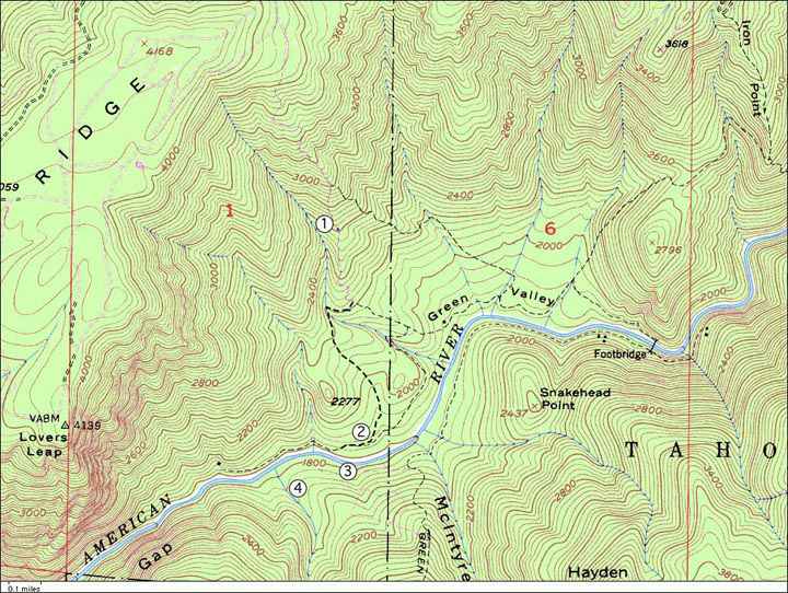
A portion of the USGS 7.5 minute Dutch Flat
quadrangle. Numbered locations are referenced in the photo captions
below. Note that the 1800-foot contour crosses the river near
(3), and that the best-preserved of the highest, possibly Sherwin-age
gravels, are exposed at Snakehead Point. Here the gravels are
fully 600 feet above the present elevation of the river. Beneath
the "nak" of "Snakehead" and the "oi"
of "Point" is the course of one of the many relict channels
of the North Fork in Green Valley; the bedrock floor of this relict
channel is a little above the 2200-foot contour, and 400 feet
above the present river.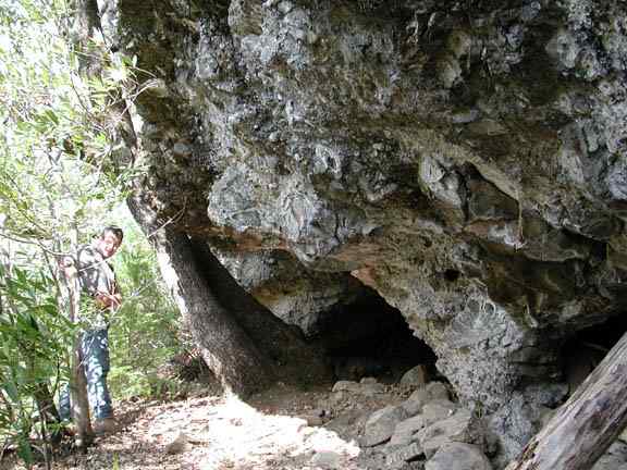
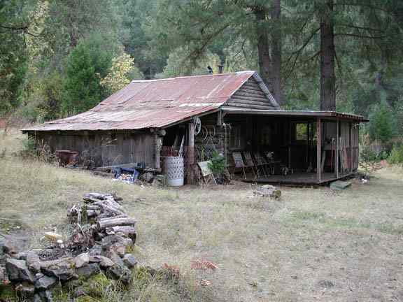
Tom Molloy, at the entrance of a cave at
the base of cemented agglomerate at numbered location (1), near
the 2600-foot contour and thus 800 feet above the present river
level. This cave was occupied in the 19th century and then again
in the 20th century, probably during the Depression. A stovepipe
leads from within the cave, up a fissure to the flat top of this
terrace of cemented sediments. The terrace is on steep slopes
flanking Ginseng Ravine, about 200 feet above the creek.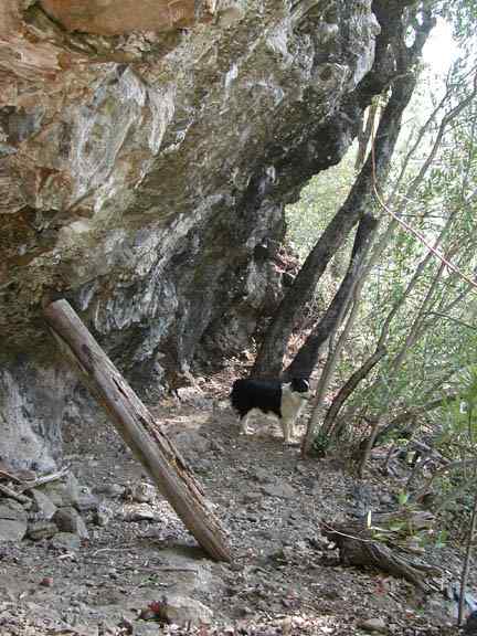
This picture is also at location (1), looking
in the opposite direction, along the base of the terrace of cemented
sediments. The clasts of rock in the agglomerate are mostly angular,
unrounded or only slightly rounded fragments of the local bedrock,
which is the serpentine and associated ultramafic rocks of the
Melones Fault Zone. However, perhaps two percent of the clasts
are rounded cobbles of andesite, almost certainly derived from
the Mehrten Formation andesitic mudflows. These mudflows cap Moody
Ridge directly above this site. The cemented terrace is akin to
another at nearly this same level, in another ravine to the east.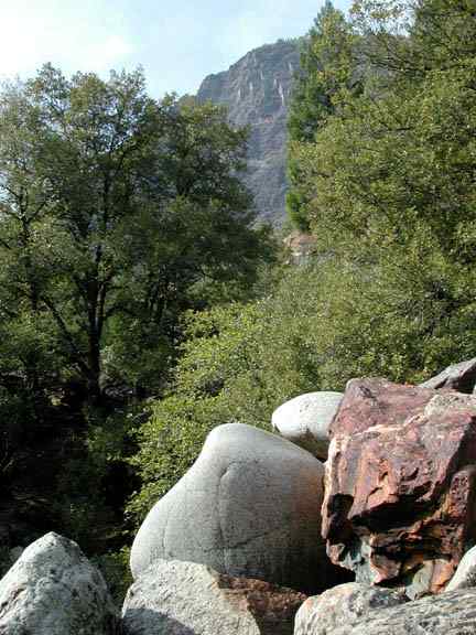
The High West Trail forks away from the main trail at about the 2200-foot contour, crosses Ginseng Ravine, and then descends through scanty and poorly-exposed Pleistocene sediments, the presence of which is marked mainly by serpentine-intolerant Ponderosa pines, on slopes which gradually flatten and merge into a terrace of likely Tioga-age outwash gravels near the river.
The thick section of graveks here was worked by a hydraulic mine in the 1870s, the Green Valley Blue Gravel & Mining (GVBG&M) Company (location (2)). Accounts of this claim may be found on my Green Valley page, in the mining history section. Large boulders are heaped in stacks along the West Trail, above the river, and a fair precentage of these are granitoid. Their source may be in the South Yuba basin, since there was very considerably overflow of ice from the (mainly granite) South Yuba into the (mainly metamorphic) North Fork, and this ice carried quantities of granite boulders along with it, as can be seen at many places along the dividing ridge, miles to the east and north of Green Valley.
In the photo above, Lovers Leap can be seen
looming over Green Valley, to the west.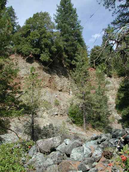
Location (2). Here the working face of the
GVBG&M Co. hydraulic mine is seen, above and behind one of
the piles of big boulders (foreground). The top of the bank is
a flat terrace surface at about the 2000-foot contour, roughly
paired with that of the Gold Ring Mine, across the river to the
south. I guess this terrace to be Tioga in age and thus to mark
the filling of Green Valley by glacial outwash sediments to a
depth of 200 feet, between, say, 14,000 and 25,000 years ago.
The unconsolidated sediments are well-stratified. Mining has exposed
a bedrock surface (not visible here) at the base of the gravels,
in places exhibiting polish and potholes. The undulating bedrock
surface is about 40 feet above present river level.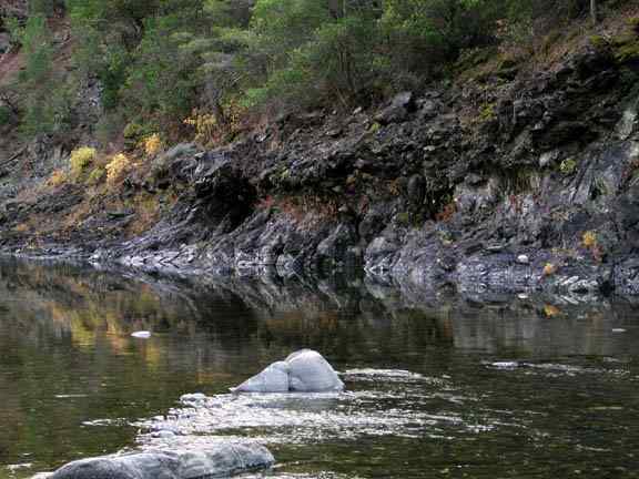
Directly across the river to the south from
location (2), location (3) exhibits a complex of various sediment
types. In the photo above, a terrace of heavily cemented glacial
outwash clings to the serpentine bedrock. The most recent bridge
in Green Valley (ca. 1940), a suspension bridge, crossed the river
here. The bridge was built by Joe Steiner, a Swiss miner who llived
in Green Valley from the 1920s until his death in the 1950s. A
gently-sloping trail to the Gold Rin Mine (to the right, and about
one-half mile west) begins at the far end of this cemented terrace.
There is another prominent terrace of cemented outwash about 150
feet above this one, and between the two terraces are peculiar,
steeply-dipping strate if fine-grained, light-colored sediments.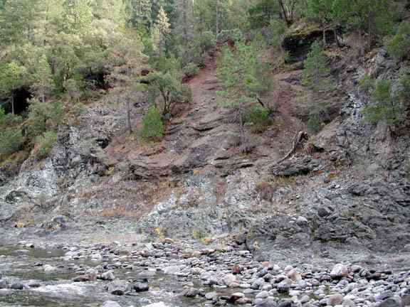
Location (3), immediately upstream from
the photo above. Here the steeply-dipping fine sediments--themselves
peculiarly well-consolidated--and the higher cemented terrace,
are visible. It is worth noting that every exposure of cemented
conglomerate and agglomerate in Green Valley is in direct contact
with serpentine bedrock. Other older Pleistocene sediments are
still higher on the slope, out of view.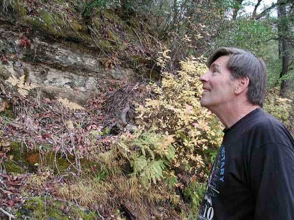
Location (3). Larry Hilberg stands near
an exposure of the fine-grained, light-colored sediments which
occupy a zone between two terraces of cemented outwash gravel,
one below, near river level, and one about 150 feet above the
river. Five-finger ferns and rhododendrons grow from these strata,
indicating that they conduct groundwater, although these steep
north-facing slopes have a better soil-moisture budget in any
case.
Location (4). The Depression-era log cabin
at the Gold Ring Mine. This meadow is another terrace of Tioga-age
outwash gravels, and is of much the same elevation as that at
the GVBG&M Co. mine, across the river to the north.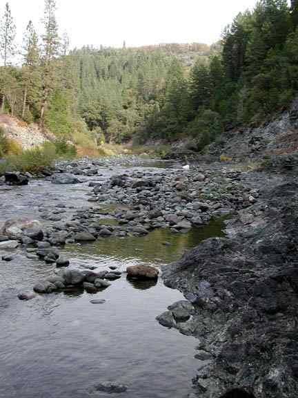
The view upstream from the cemented terrace at the bridge site. The flat-topped ridge in the background is Snakehead Point, with its fringe of serpentine-intolerant black oaks on the summit marking the presence of glacial outwash sediments fully 600 feet above the river. In the right foreground, serpentine bedrock is exposed, which was entirely covered with cemented gravels until this channel of the North Fork was exhumed following the end of Tioga glaciation around 12,000 years ago. Vestiges of these cemented gravels still cling to the bedrock at river level (not visible in this photo). This shows that this channel, at any rate, was incised before its most recent burial by Tioga outwash sediments. During perhaps 10,000 years of burial, vagaries in the circulation of mineralized groundwater strongly cemented portions of the sediments. When the glaciers retreated up the North Fork canyon, the sediment load diminished and the river began cutting down through the outwash plain towards bedrock.
The Holocene gravels visible in the river
itself are predominantly reworked Pleistocene outwash. The actual
bedrock floor of the present channel is at an unknown depth beneath
these reworked sediments, and may be as much as forty feet down,
in places.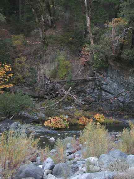
From just west of location (2) on the north bank of the river, and just upstream from the long deep pool at the terminus of the West Trail, one can see a relict channel of the North Fork, on the south bank, filled in part with stratifed, light-colored, fine-grained sediments. These can be seen in the center of the photo above near the tangle of fallen trees across the river. A narrow ridge of serpentined separates the main, present channel from this relict channel. The light-colored, fine-grained sediments are exposed at several locations in Green Valley. Most often they ae sands, but beds of light-colored clay are also found.
The relict channel here proceeds an unknown
distance west, parallel to the main channel. Approximately three-quarters
of a mile west, a tunnel in solid rock on the south bank of the
river, breaks through into glacial outwash sediments containing
massive boulders and cemented gravels. This may be part of the
same relict channel.